California Wildfire photos

All posts tagged California Wildfire photos

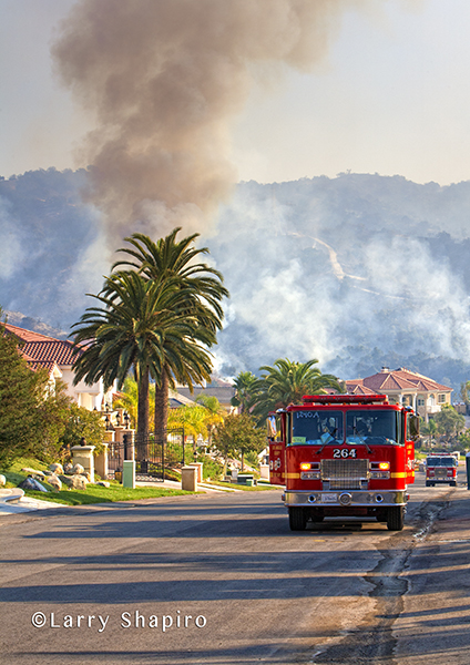
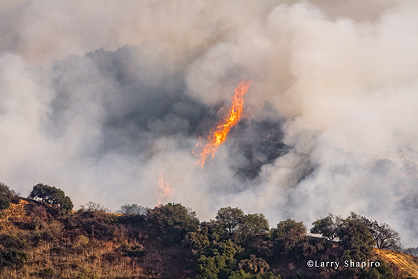
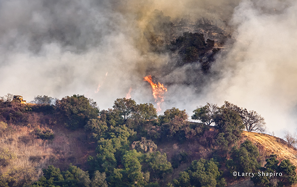
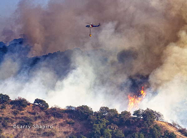
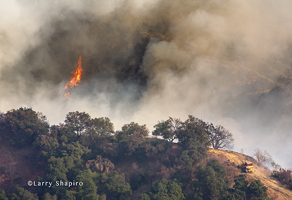
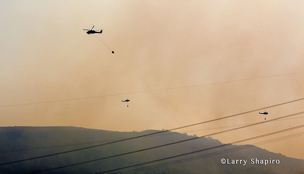
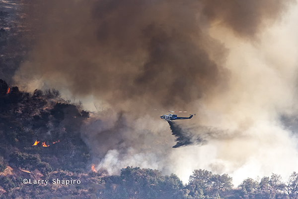
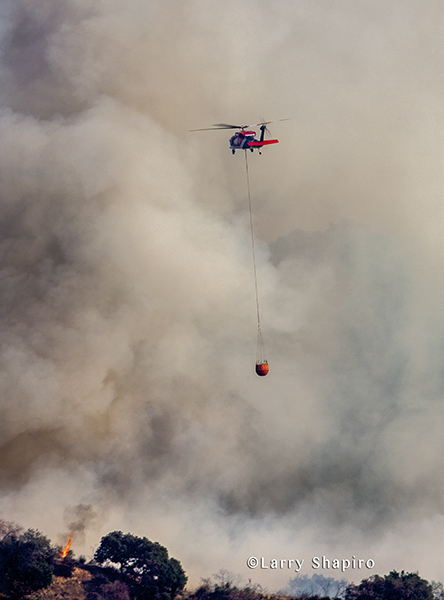
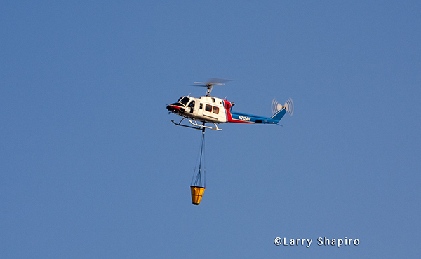
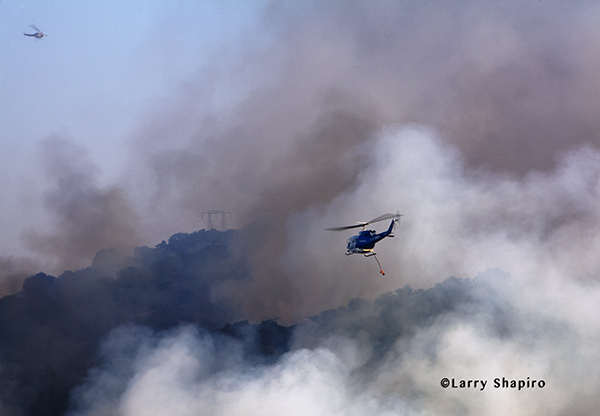
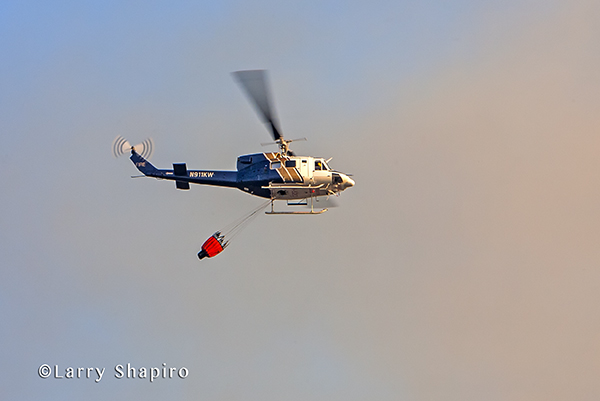
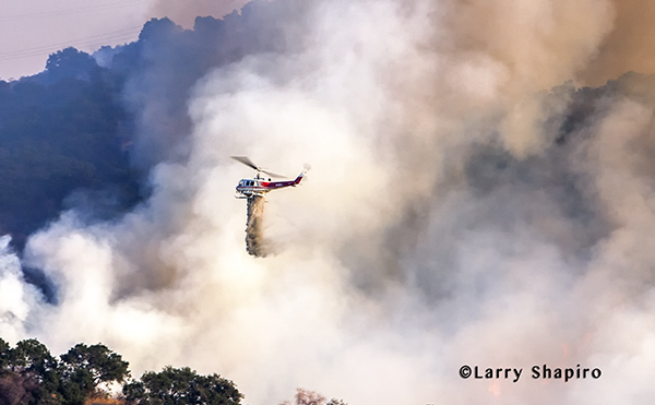
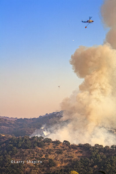
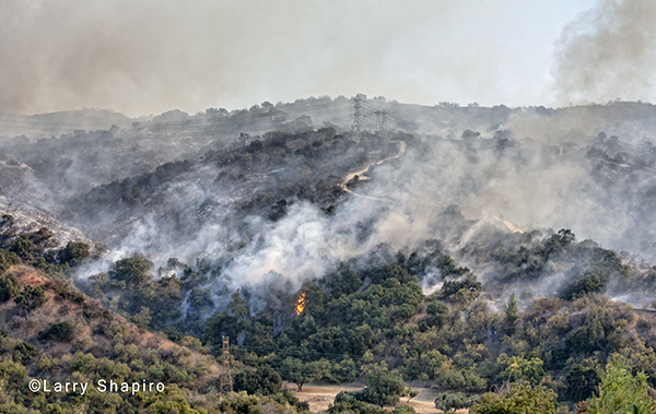
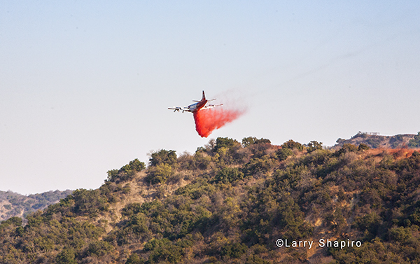
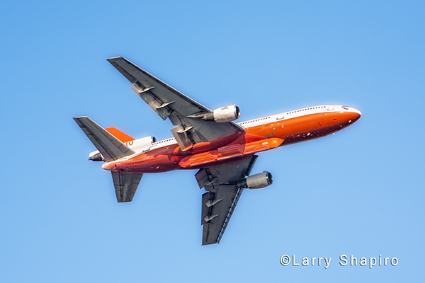
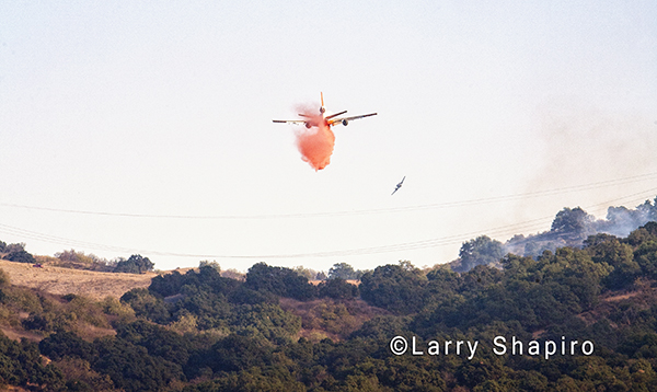
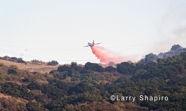
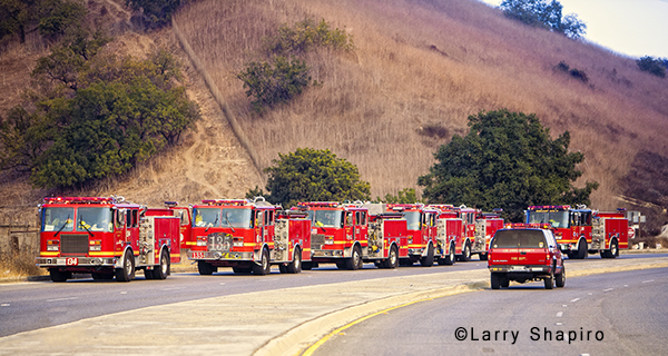
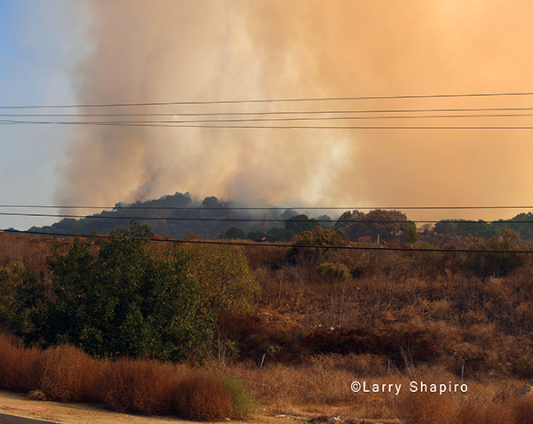
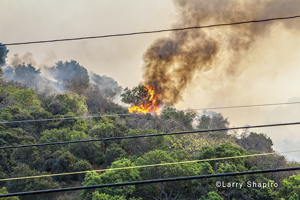
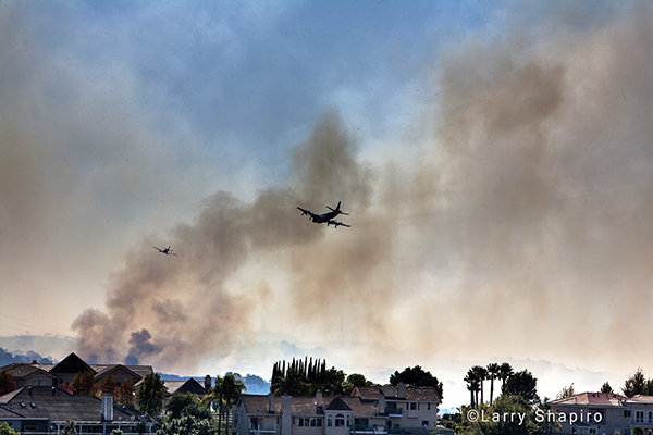
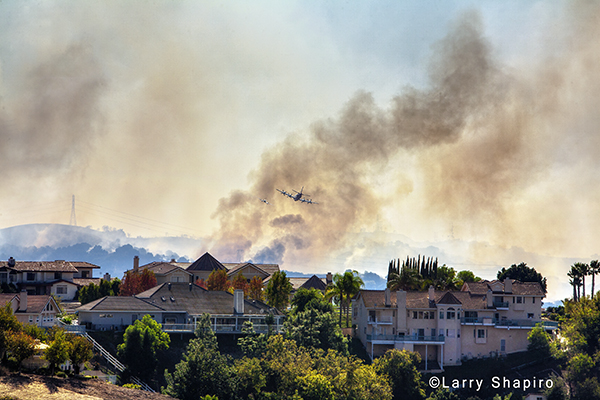
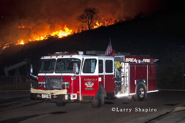
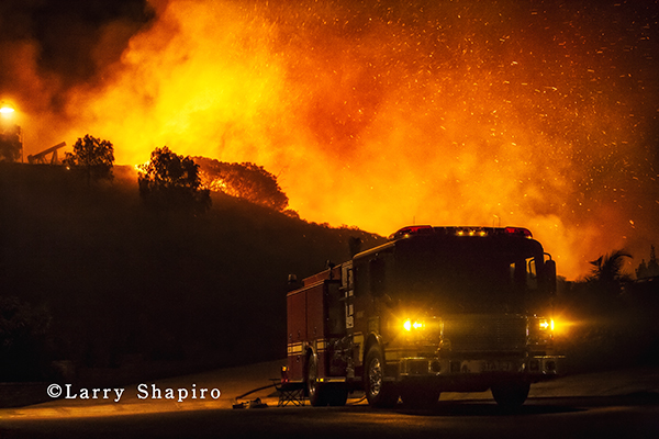
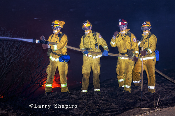
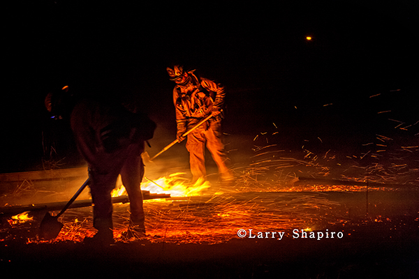
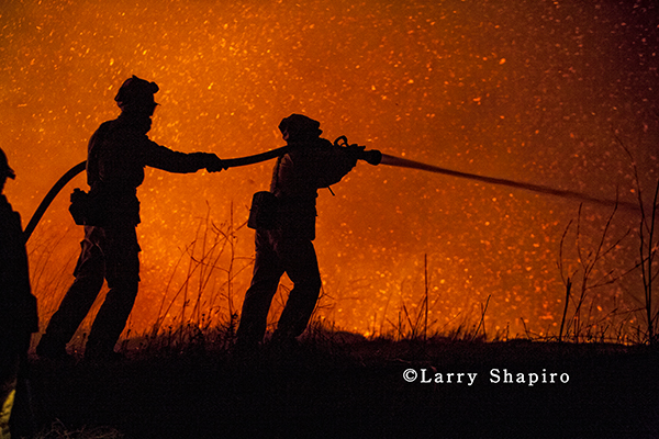
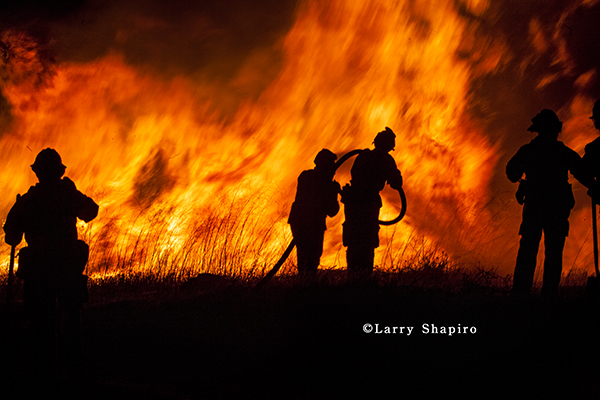
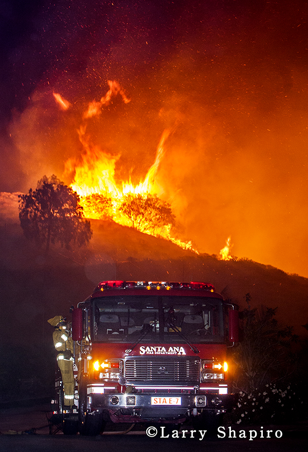
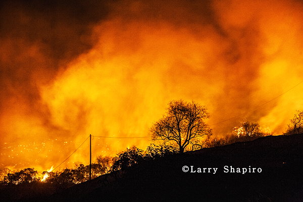
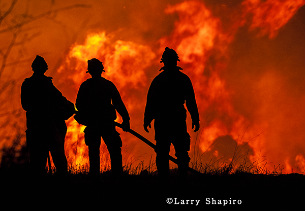
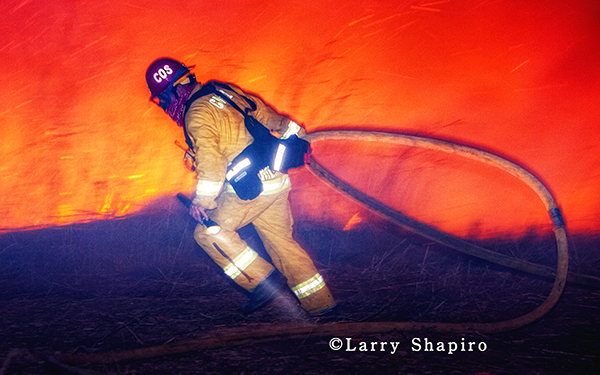
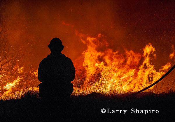
Here are random dramatic images of several wildfires that have stretched firefighting resources very thin throughout the Western United States

Bitterroot National Forest in Montana, United States

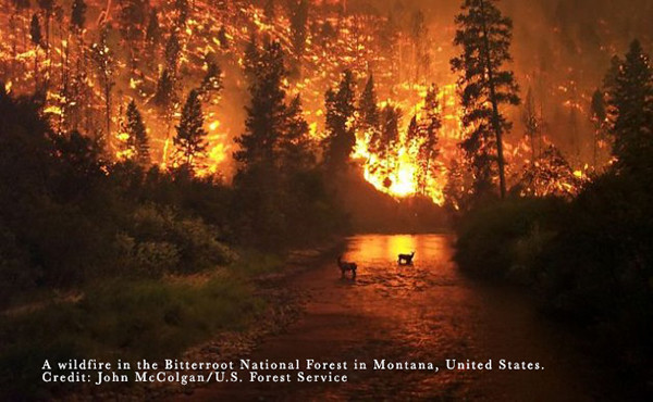
A wildfire in the Bitterroot National Forest in Montana, United States. Credit: John McColgan/U.S. Forest Service

 the Rocky fire near Clearlake, California

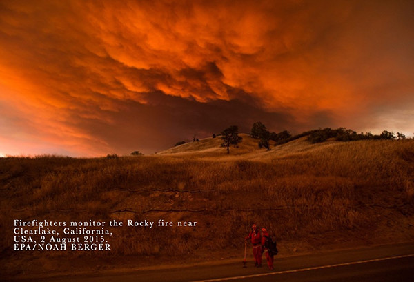
Firefighters monitor the Rocky fire near Clearlake, California, USA, 2 August 2015. EPA/NOAH BERGER

2015 California wildfire

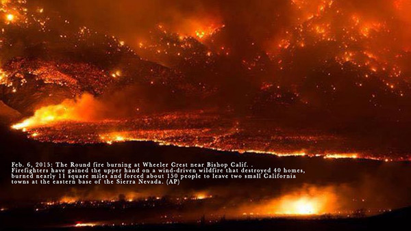
Feb. 6, 2015: The Round fire burning at Wheeler Crest near Bishop Calif. . Firefighters have gained the upper hand on a wind-driven wildfire that destroyed 40 homes, burned nearly 11 square miles and forced about 150 people to leave two small California towns at the eastern base of the Sierra Nevada. (AP)

wildfire at night

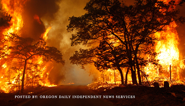
POSTED BY: OREGON DAILY INDEPENDENT NEWS SERVICES

California wildfire

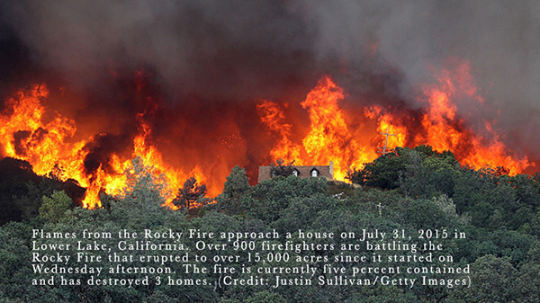
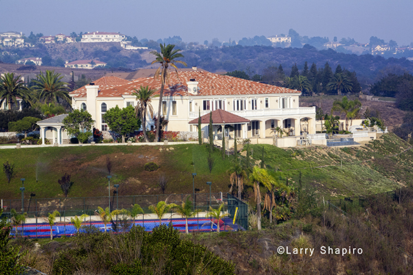
Flames from the Rocky Fire approach a house on July 31, 2015 in Lower Lake, California. Over 900 firefighters are battling the Rocky Fire that erupted to over 15,000 acres since it started on Wednesday afternoon. The fire is currently five percent contained and has destroyed 3 homes. (Credit: Justin Sullivan/Getty Images)

 the Lake Fire in California

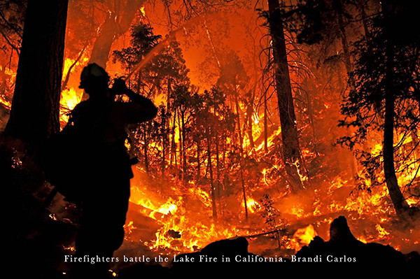
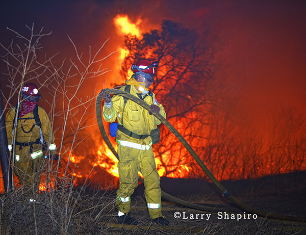
Firefighters battle the Lake Fire in California. Brandi Carlos

Rocky Fire in California

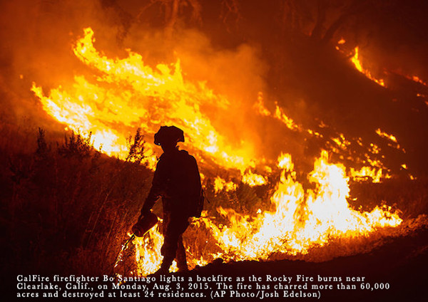
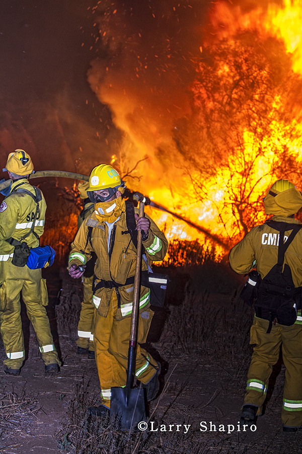
CalFire firefighter Bo Santiago lights a backfire as the Rocky Fire burns near Clearlake, Calif., on Monday, Aug. 3, 2015. The fire has charred more than 60,000 acres and destroyed at least 24 residences. (AP Photo/Josh Edelson)


The last part of this series from the Freeway Complex Fire in 2008 at Diamond Bar, CA.

Freeway fire in 2008

A Los Angeles County engine stands by among huge homes on a street in Diamond Bar as the fire burns in a canyon to the south. Larry Shapiro photo

Freeway fire in 2008

Heavy fire burns in the canyon south of Diamond Bar, CA. Larry Shapiro photo

Freeway fire in 2008

A dozer works on a fire break in the canyon. Larry Shapiro photo

Freeway fire in 2008

A water drop from a helicopter. Larry Shapiro photo

Freeway fire in 2008

A dozer works on a fire break in the canyon. Larry Shapiro photo

More can be seen at shapirophotography.net

Here are some images depicting air drops from the rotary-wing aircraft . Included are a Sikorsky Firehawk, a Super Huey Bell Helicopter, and two Bell 205s.

helicopters working at wild land fire

Three helicopters visible in the queue for water drops. Larry Shapiro photo

helicopter working at wild land fire

A Bell 205 makes a drop. Larry Shapiro photo

helicopter working at wild land fire

A Sikorsky Firehawk about to make a drop. Larry Shapiro photo

helicopter working at wild land fire

A Bell 205 with a full bucket approaching the drop site. Larry Shapiro photo

helicopters working at wild land fire

A helicopter heading into the smoke to make a drop. Larry Shapiro photo

helicopter working at wild land fire

One of the helicopters returning to refill. Larry Shapiro photo

helicopter working at wild land fire

A Huey making a water drop. Larry Shapiro photo

helicopters working at wild land fire

A helicopter near the ridge line makes a drop as two others circle back to refill. A fixed-wing tanker in the distance is gong to make a drop in another sector. Larry Shapiro photo

Other posts in this series: Part 1, Part 2, Part 3

Here are some images depicting air drops from the fixed-wing air tankers. One is a Lockheed P-3 Orion which is capable of  dropping 3,000 gallons of fire retardant, and the other is a McDonnell Douglas DC-10 which can carry 12,000 gallons of water or retardant.

Some data on the DC-10 from CALFIRE:

  • Originally delivered as a civil passenger plane to National Airlines in 1975, it subsequently flew for Pan Am, American Airlines, Hawaiian Airlines and Omni International.

  • The DC-10 is the only wide-body jet air tanker currently in the fire service. The aircraft, operated by 10 Tanker Air Carrier, is used for fighting wildfires, typically in rural settings. The turbofan-powered craft carries up to 12,000 gallons of fire retardant in an exterior belly-mounted tank, which can be released in eight seconds. This aircraft will not be used on all fires, and will not be used on initial attack. It is utilized in extended attack fires as it is limited in time effectiveness for reloading fire retardant as well as its need to reload and refuel at an equipped aerial firefighting base (currently Victorville and McClellan are the only bases in California serviceable for this large an aircraft). One drop for the DC-10 is equivalent to 12 drops of an S2-T or a line of retardant that is 300 feet wide by one mile in length.

Freeway fire in 2008

Fire is burning in the hills near Diamond Bar, CA in 2008 as part of the Freeway Complex Fire. Larry Shapiro photo

mansion in Diamond Bar California

An example of the homes in the evacuated neighborhood in Diamond Bar. Larry Shapiro photo

P3 Orion working at the Freeway fire in 2008

P3 Orion air tanker working at the Freeway fire in 2008. Larry Shapiro photo

DC-10 working at the Freeway fire in 2008

DC-10 outfitted for firefighting operations flies low over the neighborhood as it lines up for a drop. Larry Shapiro photo

DC-10 working at the Freeway fire in 2008

Following it’s lead plane, the DC-10, begins it’s drop. Larry Shapiro photo

DC-10 working at the Freeway fire in 2008

Capable of dropping retardant over an area a mile long, the DC-10 continues to spread retardant. Larry Shapiro

More images of the southern California wildfires from November of 2008. These were in Diamond Bar in LA County on 11-16-08.

This is from the CALFIRE website at the time:

An exclusive enclave of multi-million homes in Diamond Bar is being evacuated, according to officials at the Walnut Sheriff’s substation.

The estates are home to rapper Snoop Doggy Dogg and U.S. Rep Gary Miller as well as several other celebrities and sports figures. The Triangle Complex Fire that has already jumped from one city to another in the hills between Anaheim, Corona, and Chino has turned to the north Sunday morning, threatening homes in the Los Angeles County city of Diamond Bar.

Wind was driving fire west Saturday night, and threatened La Habra Heights (and for that matter, all the way to Rose Hills). Overnight, winds died, geography took over, and the fire went NNE through the Carbon Canyon “chimney”, to Diamond Bar by Sunday morning.

The gated Country Estates community in Diamond Bar was the first section firefighters decided to evacuate and by Sunday afternoon, 1,400 Diamond Bar residents were told to evacuate as the blaze pushed toward multi-million dollar homes and a Boy Scouts camp.

LA County Strike Team at wild land fire

LA County Strike Team staged. Larry Shapiro photo

Freeway fire in 2008

Another section where fire is burning in the hills alongside a freeway as the fire moves from Orange County into LA County. Larry Shapiro photo

Freeway fire in 2008

Fire is burning in the hills alongside a freeway as the fire moves from Orange County into LA County. Larry Shapiro photo

air tanker and spotter during wildfire

An air tanker follows his lead or spotter plane as he nears a drop site outside of Diamond Bar, CA in 2008. Larry Shapiro photo

air tanker and spotter during wildfire

The planes are flying over a very affluent section of the Los Angels suburb of Diamond Bar, CA in 2008. Larry Shapiro photo

In November of 2008, I had the good fortune to be able to travel to southern California during a period of wildland and urban interface fires. Over the course of two days, there were a series of three different fires that occurred in near proximity to each other. They were dubbed the Brea, Yorba Linda, and Carbon Canyon fires in Orange County. As the winds moved the fires, the boundaries of each became blurred, and they expanded into each other. This new combination of the fires was named the Freeway Complex Fire … also at some point the Triangle Complex Fire.

Freeway Complex Fire photos

Larry Shapiro photo

Freeway Complex Fire photos

Larry Shapiro photo

Images here are from what was originally the Brea fire, shot at the end of a cul-de-sac where two engine companies had taken defensive positions to protect the homes on this block from the fire that was traveling along the ridge line. One engine was from Brea and the other was Santa Ana. There were homes in a canyon behind this area that was too dangerous for companies to enter, and subsequently those homes were destroyed.

Freeway Complex Fire photos

Larry Shapiro photo

Freeway Complex Fire photos

Larry Shapiro photo

Freeway Complex Fire photos

Larry Shapiro photo

Freeway Complex Fire photos

Larry Shapiro photo

Freeway Complex Fire photos

Larry Shapiro photo

Freeway Complex Fire photos

Larry Shapiro photo

Freeway Complex Fire photos

Larry Shapiro photo

Freeway Complex Fire photos

Larry Shapiro photo

Freeway Complex Fire photos

Larry Shapiro photo

Freeway Complex Fire photos

Larry Shapiro photo

Freeway Complex Fire photos

Larry Shapiro photo

A gallery with many more images.